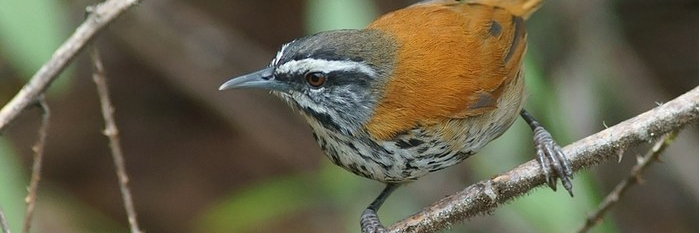
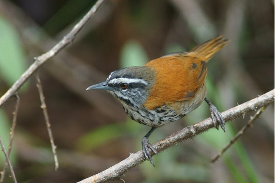
The Abra Malaga is a route that starts in the town of Ollantaytambo, Cusco and runs along the 28B Ollantaytambo – Quillabamba road through unique Andean ecosystems. This route contains two types of well-defined areas: El Abra (4,297 meters above sea level) and the lower zone (Carrizales 3,245 meters above sea level). The birds you can see are rare and highly sought after.
The predominant ecosystem is the rain forest Montano Tropical or cloud forest in the Carrizales area, with low-rise tree forests covered by epiphytic plants and also some bamboo areas. In the Abra Málaga, at 4,200 meters high, we are in a tropical rainforest-Montano moor, with small Polylepis forests at the basin births.
History
The birdlife in this area of
was studied since 1869 by Sclater and Salvin, Berlepsch and Stolzmann (1906).
In 1915 an expedition of the Geographical Society Machu Picchu is made, directed by Frank M. Chapman and George K. Cherrie (July 1-24, 1916), and by Harry L. Watkins (April 3-25, 1917).
From September 1974, June 1976, 1977 and 1978, October 1978 and August 1979, personnel from the Zoological Museum of Louisiana State University (LSU) visited the valley to conduct an inventory and increase knowledge of birds and small mammals. Three main camps were made along the Ollantaytambo-Quillabamba road through the Abra Málaga (3900 m), and a fourth was in Kiteni (450 m), after Quillabamba.
Starting from Ollantaytambo, the first place to visit is Las Peñas, located 15 Kms from the town. Named for having remains of Inca stone constructions in place. In the surroundings, between the bushes and at the edge of the road you can see: Cuzco Brush-finch, Chestnut-breasted Mountain-finch, Tyrian Metaltail, Shining Sunbeam, White-tufted Sunbeam, Puna Tapaculo, White-browed Conebill.
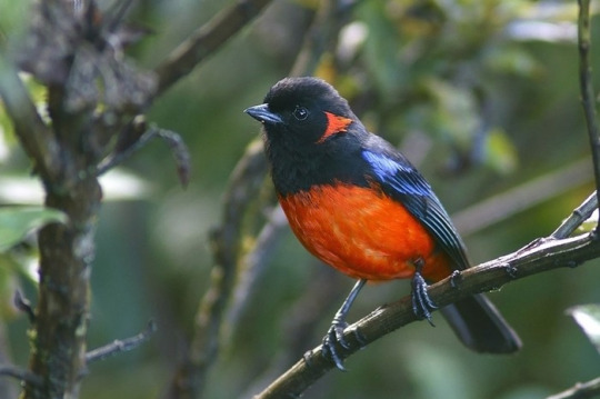
Another place of interest is the descent of the Abra, on the way to Quillabamba, where the good places are the Vegetation patches around the track, there you can see the Puna Thistletail, Unstreaked Tit-tyrant, Creamy-crested Spinetail, Diademed Tapaculo, Thrush- like Wren, Rufous-chested Tanager, Buff-breasted Mountain-tanager, Chestnut-bellied Mountain-tanager, Scarlet-bellied Mountain-tanager, White-bellied Hummingbird.
The Abra Málaga Thastayoc is the highest point of the route and is the safest and most accessible area to see the Royal Cinclodes. To do this you must follow the path that starts at the checkpoint, located at the highest point of the Abra. From there follow the path until you reach a Polylepis forest located at 4,150 meters high. You can also see the Stripe-headed Antpitta, Blue-mantled Thornbill, Shining Sunbeam, Puna Tapaculo, White-browed Tit-spinetail, Tawny Tit-Spinetail. The route for this forest is very rugged and long. It takes 2-3 hours to travel.
Weather
The weather is rainy between the months of November to April, and temperate with infrequent rains between the months of May to October. The temperature varies from -5 degrees in the Abra Málaga to 20 degrees in the Carrizales area.
Policies
Along the road it is not necessary to make any payment. To enter the Cinclodes route, it is necessary to pay an entrance fee, differentiated for Nationals and Foreigners. This payment is made at the checkpoint. Here you have bathrooms.
INFORMATION OF INCA JUNGLE


Leave a comment